
MENU
INITIATIVES / FIELD STORY
Rural School Connectivity
Mini Project.
A school connection. A wider circle of opportunity.
Exploring how existing satellite infrastructure can reach further into the communities around it.
01 / THE OPPORTUNITY
A connection at school.
An opportunity beyond its gates.
For a rural school, an internet connection can open a door to digital learning. But the value of that connection depends on where people can use it. A satellite link may reach the school while the local Wi-Fi signal serves only a much smaller area.
The Rural School Connectivity Mini Project began with a practical question: could that existing connection serve a wider local footprint? Rather than treating satellite access and local coverage as separate challenges, the project brought them together in one integrated approach.
In collaboration with BAKTI and supported by SATRIA-1 satellite infrastructure, SEATELSAT financed and integrated a low-band access solution at two school locations: Jeneponto and Gorontalo. The work focused on extending usable access and understanding how a wider group of users would make use of it.
02 / THE CHALLENGE
Getting connected was the beginning.
Making the connection reach further was the next step.
A school’s satellite terminal provides an upstream path to the internet. Local access is a different part of the journey: it determines whether that connection is useful across the school grounds and for nearby users.
The project explored how low-band access could carry connectivity beyond the original short-range Wi-Fi footprint. It also addressed a less visible integration challenge: carrying the access network’s local requirements across an existing IP-based satellite service.
The aim was to build on infrastructure already in place. Wider coverage would only be meaningful if it could work with the existing backhaul and support practical use by schools, teachers and the surrounding community.
03 / THE SOLUTION CONCEPT
One satellite connection.
A wider circle of opportunity.
The architecture combined SATRIA-1 satellite backhaul with a low-band access network. The school remained the local point of connection, while the access network extended the area in which people could use the service.
An Ethernet-over-IP transport gateway bridged the local Layer 2 requirement across the satellite path. This allowed the access network to be integrated with the existing IP-based upstream service, rather than requiring the satellite service to be replaced.
- 01 / PEOPLE
School & community access
Students, teachers and nearby users connect through local devices and access points.
- 02 / LOCAL REACH
Low-band access site
A wider-area access network extends the usable footprint beyond the school’s original Wi-Fi reach.
- 03 / THE BRIDGE
Transport & satellite backhaul
Ethernet-over-IP integration carries the access network across existing VSAT and SATRIA-1 infrastructure.
- 04 / SERVICES
Core & internet services
The integrated path connects local users with upstream network and internet services.
Coverage depends on terrain, tower height, device configuration and radio conditions. The concept’s indicative radius of up to 10 km is a planning illustration; the reported field observation for this project was up to 5 km.
EXPLORE THE DETAILED SOLUTION CONCEPT
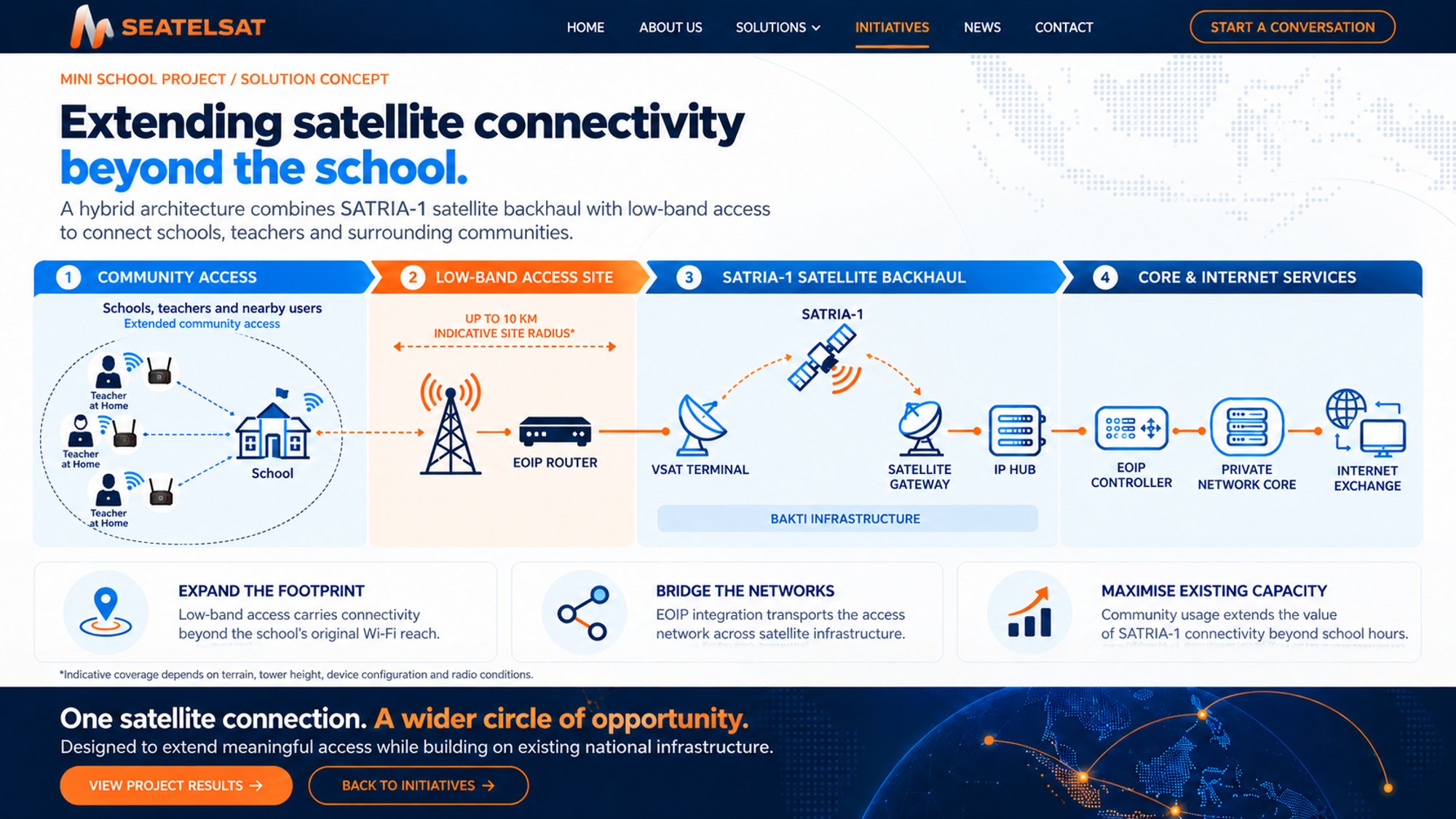
The diagram shows the intended integration concept. Indicative coverage should be assessed against local conditions and the field results below.
04 / THE IMPLEMENTATION JOURNEY
From a school requirement
to evidence in the field.
The work moved from documenting the existing service to integrating the network, deploying it at two school locations and measuring the results. SEATELSAT’s financing and integration role connected the technical concept with the practical work required to make it usable on site.
The implementation story is as much about integration as it is about coverage. Existing VSAT service, the school’s original Wi-Fi footprint and local user needs formed the starting point. The access network and transport gateway then had to work together across the satellite service.
- 01
Site baseline
Document the existing VSAT service, Wi-Fi footprint and local user requirements.
- 02
Network integration
Connect low-band access through an Ethernet-over-IP transport gateway.
- 03
Field deployment
Install and configure the access network at two school locations.
- 04
Performance measurement
Measure availability, coverage, throughput and traffic timing.
- 05
Expansion assessment
Use field evidence to identify where wider deployment may be appropriate.
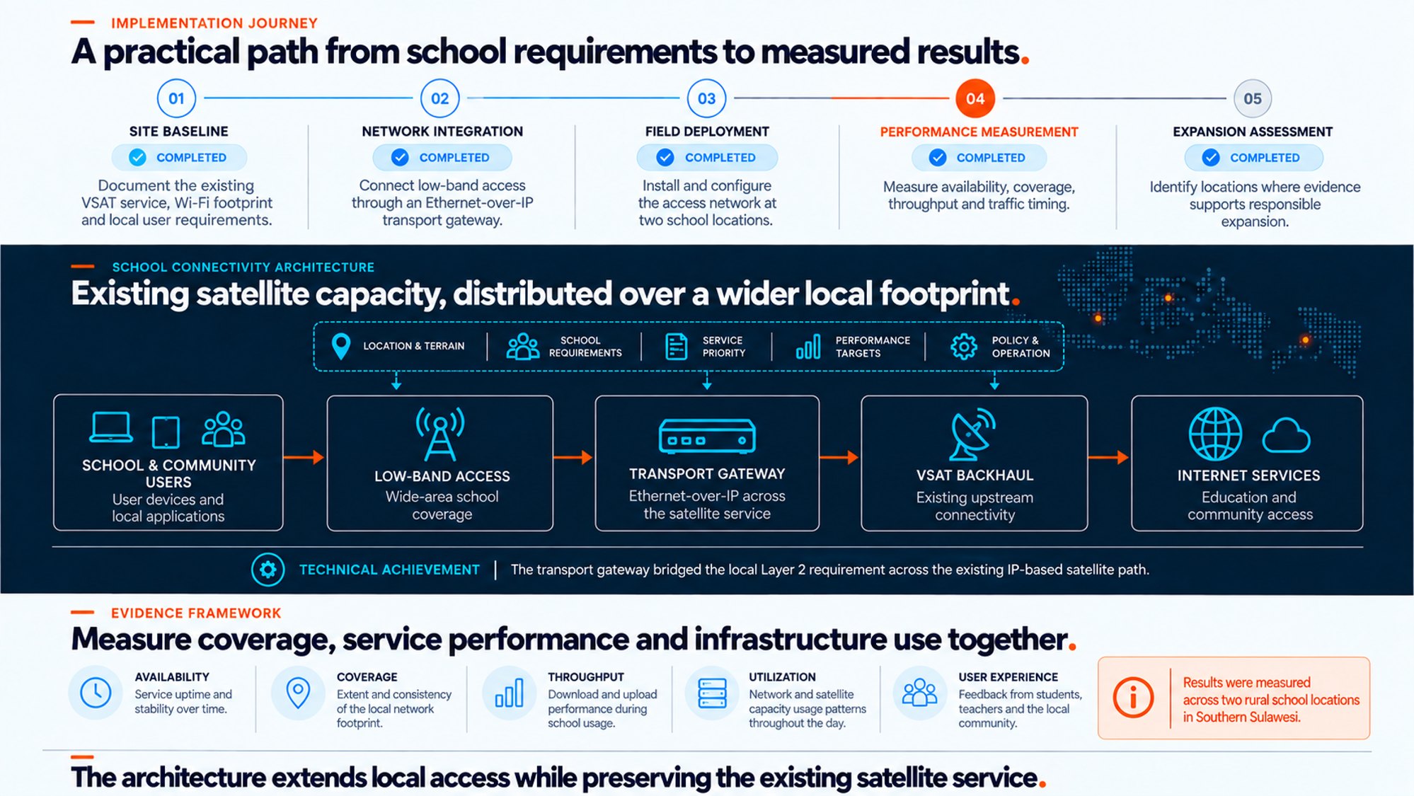
Technical achievement: the transport gateway bridged the local Layer 2 requirement across the existing IP-based satellite path.
AT THE SCHOOL SITE
Infrastructure in place.
Learning at the centre.
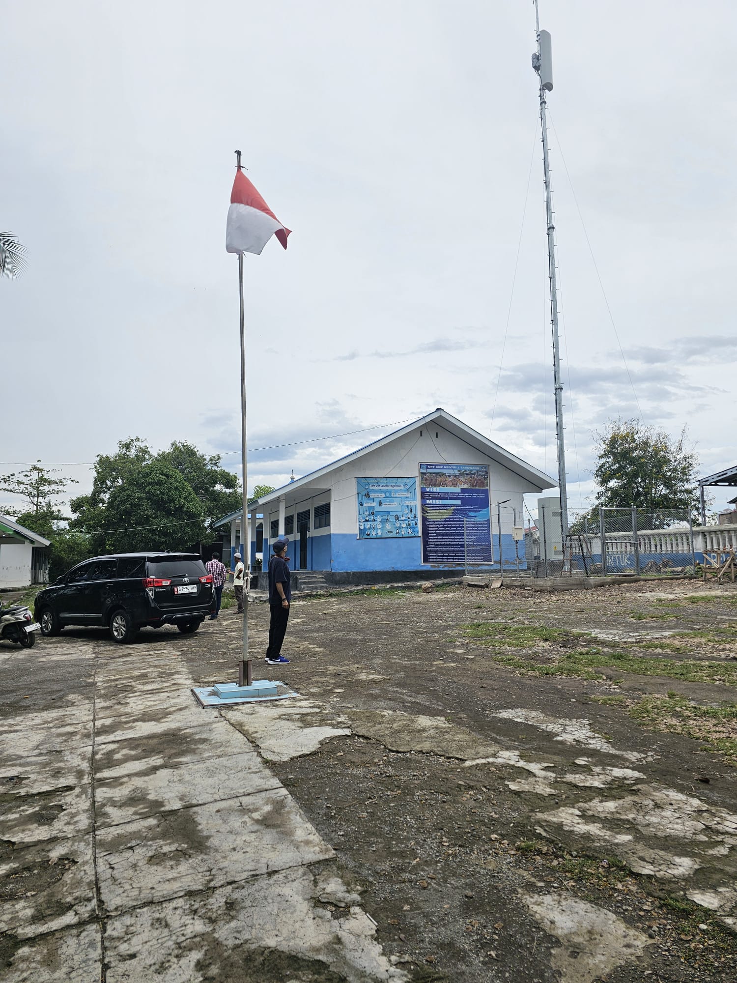
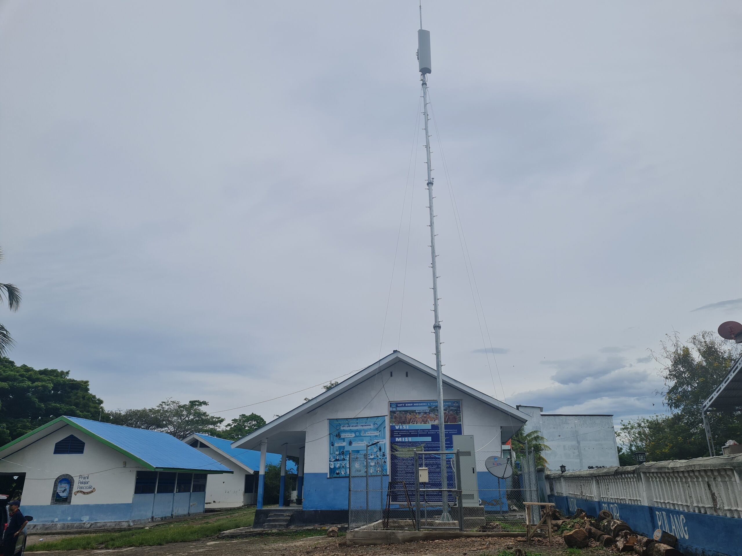
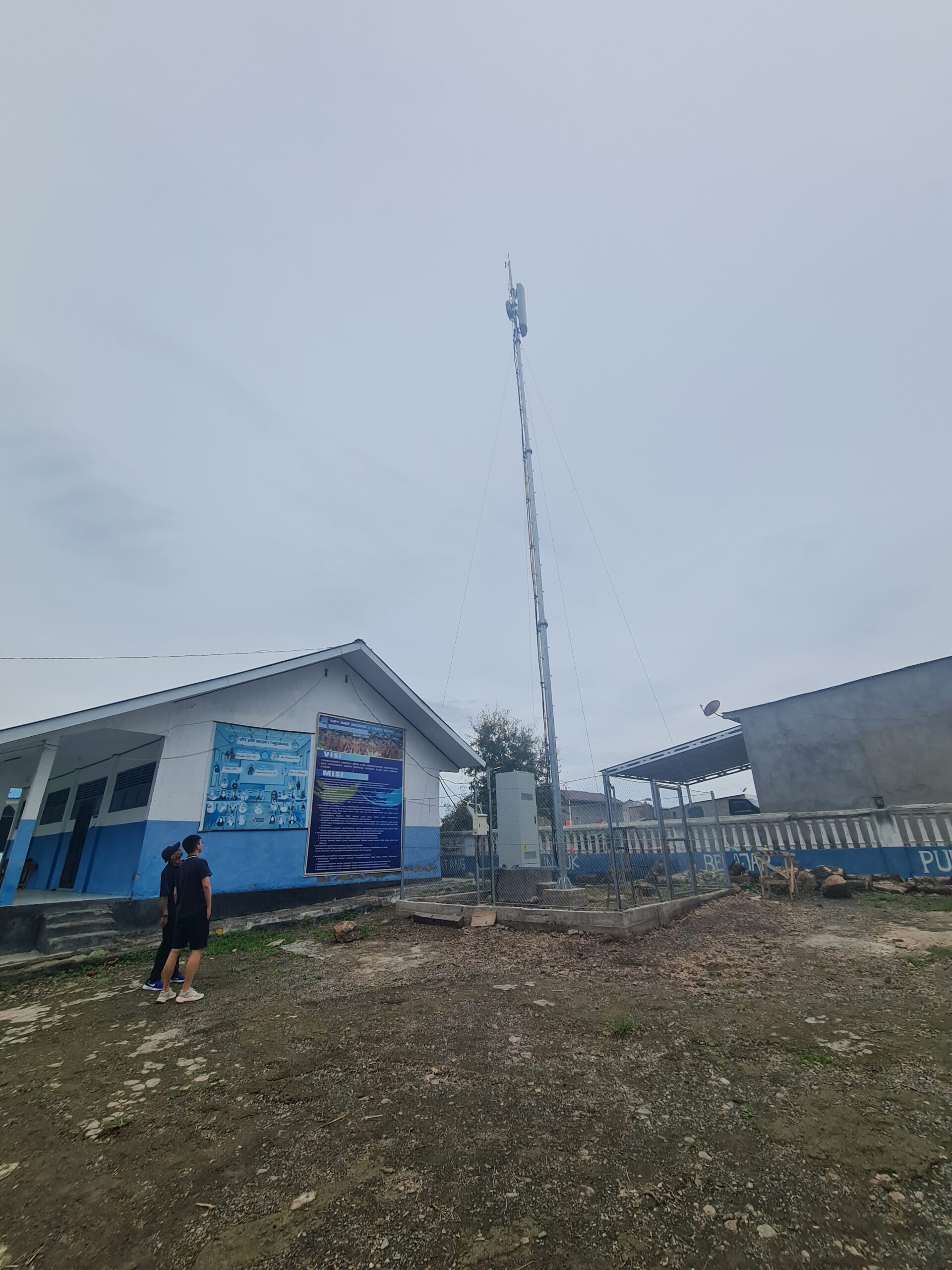
The site photographs place the technical story in its everyday setting: school buildings, an access mast and satellite equipment within the same grounds. The project’s purpose was to make the connection already reaching the school useful across a wider local area.
The Rural School Connectivity Mini Project brings those elements together. SEATELSAT’s financing and systems integration supported the practical work of extending school connectivity through low-band access and existing satellite backhaul.
05 / RECORDED FIELD RESULTS
Two school locations.
A measurable extension of access.
The reported results show that the 20-metre tower extended usable coverage beyond the original short-range Wi-Fi footprint. The project recorded availability at both locations, observed coverage of up to 5 km and peak throughput of 29 Mbps download and 8 Mbps upload.
These measurements describe the project’s field experience. Their value is in showing how the integrated approach performed in the locations studied, and in providing a basis for evaluating further sites.
Jeneponto availability
98.3%
Reported service availability during the project measurement period.
Gorontalo availability
99.4%
Reported service availability during the project measurement period.
Observed coverage
UP TO 5 KM
Usable local coverage reported with the 20-metre tower.
Reported peak throughput
29 Mbps DL
8 Mbps UL
Peak download and upload measurements reported for the project.
Figures are project observations supplied in the field-results material, not service guarantees for other locations. Coverage, availability and throughput depend on deployment and operating conditions.
06 / BEYOND SCHOOL HOURS
The most revealing result
was when people connected.
Extending coverage changed the potential audience for the school connection. The traffic records show that almost half of recorded usage occurred outside school hours: 49% at Jeneponto and 48% at Gorontalo.
That pattern matters. It indicates that the connection had a role beyond the classroom timetable, extending the value of existing satellite capacity into a wider part of the day. It also gives planners a reason to look at community demand alongside school requirements.
Jeneponto
232.1 GB
Recorded over 18 days
outside school hours
Gorontalo
341.7 GB
Recorded over 15 days
outside school hours
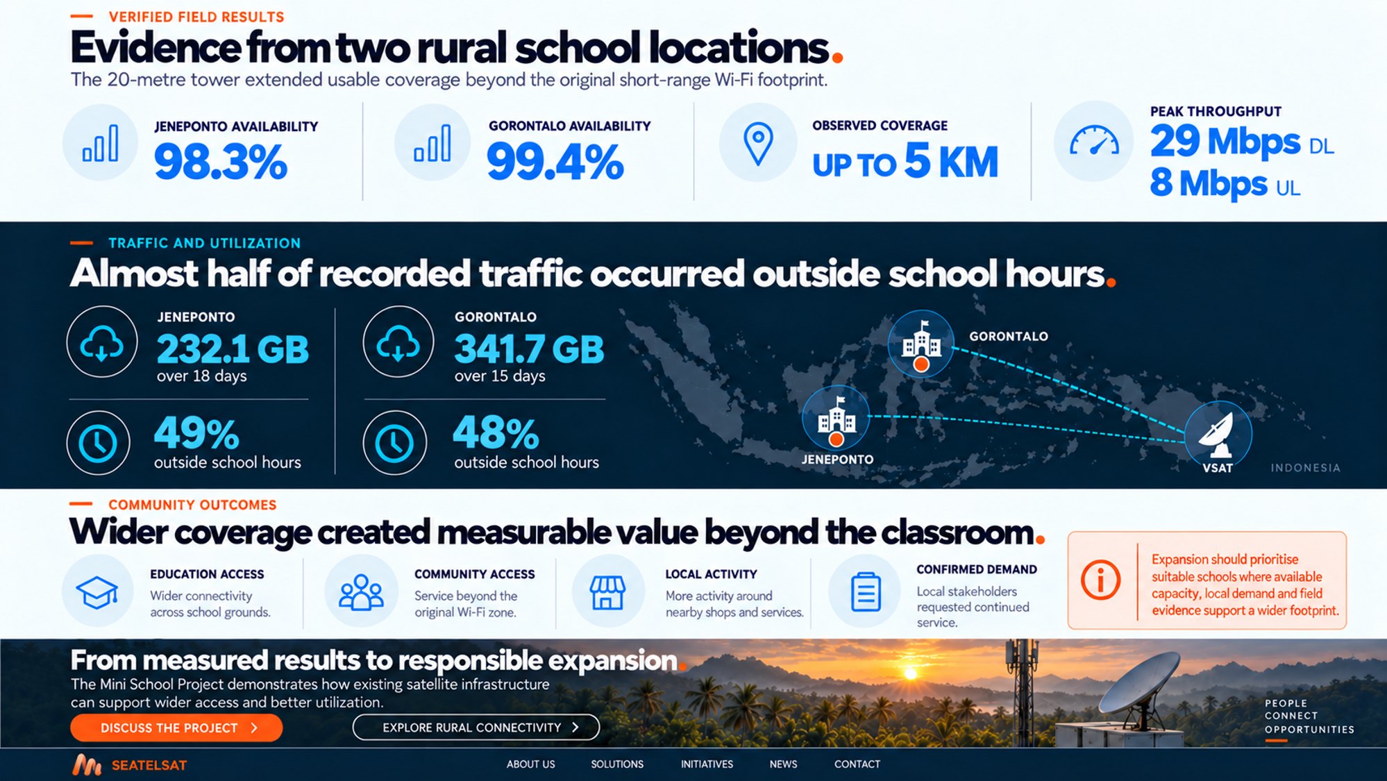
The sites were observed over different periods. Their total traffic volumes are therefore not a like-for-like comparison of site demand.
COMMUNITY OUTCOMES
Connectivity becomes meaningful
when people can use it.
The project’s outcomes reach beyond a network diagram. Wider connectivity across school grounds supported education access, while service beyond the original Wi-Fi zone created opportunities for surrounding users.
The project material also records activity around nearby shops and services, and requests from local stakeholders for the service to continue. Together with the usage records, these observations point to demand that extends beyond a single institution.
They provide a practical lesson for rural connectivity: consider the school and its surrounding community together. A wider local footprint can make better use of infrastructure already serving an essential public location.
A school can be the starting point for connectivity that serves a wider community.
Education access
Wider connectivity across school grounds.
Community access
Service beyond the original Wi-Fi zone.
Local activity
Reported activity around nearby shops and services.
Confirmed demand
Local stakeholders requested continued service.
07 / WHAT COMES NEXT
From measured results
to responsible expansion.
The Rural School Connectivity Mini Project demonstrates a way to extend local access while building on existing satellite infrastructure. It brings together three things that need to be considered together: reach, service performance and how people actually use the connection.
The next step is not to assume every school will produce the same result. Expansion should prioritise suitable locations where available capacity, local demand and field evidence support a wider footprint. Terrain, access infrastructure, integration and long-term operation all shape what is viable.
For SEATELSAT, the initiative shows how financing and systems integration can turn an existing connection into a broader opportunity—and how field evidence can guide the pathway to scale.